Blue
Backpackers [website] Busan, Korea, 19-06-08
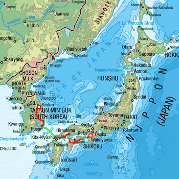
Another island, another Japan
Hashimoto to Motoyama
(4 cycling days; 2.5 hour ferry
trip; 228km; 2654m)
Hashimoto to near Sanagouchi (66 km; 192 m)
near Sanagouchi to near Koyadaira (38 m; 701 m)
near Koyadaira to Okuiya Kazurabashi (41 km; 1216 m)
Okuiya Kazurabashi to Motoyama (82 km; 545 m)
We rise to the sound of one particularly happy little
bird, chirping its head off and darting radically around
in the vicinity of our tent. Fly-fishermen are off in
the distance. It’s Sunday and the sun is stinking
hot, even at 7 in the morning. The 52 km cycle trip,
basically sticking in and around the No 24 highway,
is pretty straight forward and the ferry terminal, just
outside Wakayama, is clearly signposted the moment we
enter the city’s outskirts.
Being the last day of the weekend and
quite often the only day off for the Japanese, everyone
is out and about: busy absorbing themselves in their
extra curricular activities. I have to say, the Japanese
are pretty fanatical about anything and everything they
choose to do...

 Tip of the month: Got a bike touring or camping tip you'd
like to share?
Tip of the month: Got a bike touring or camping tip you'd
like to share?
Let's face it, this sort of info should
be shared amongst the biking and camping
enthousiast community.
So, if you have a great tip that you think
is worthy of telling everyone about, then
just send the nitty gritty details to info@tour.tk and we'll publish it in this spot as soon
as possible.
Hashimoto (Japan) - Sinlim (South Korea)
Kilometres: 1159 kilometers and 700 meters
Riding days: 18 in all
Alti meters: 11,293 !!!!
Weather: few days of dry, few days of wet
Best accommodation: Motoyama (Shikoku, Japan);
camping provided by the council. For being
scenic, peaceful, well equipped, clean and
all that for nothing.
Special thanks to:
Sony Busan, for ordering our new keyboard and
delivering it to Seoul.
Also for cleaning
our cybershot for free!! • Hoam Chul Lee for welding Son's eyelet back
on her bike for zero Won • G-zone in Goesan for the free internet • The bicycle museum in Sangju for the drinks
:-) • All Koreans who overloaded us with gifts (be
it beer, water, juices or fruit) along the
way !
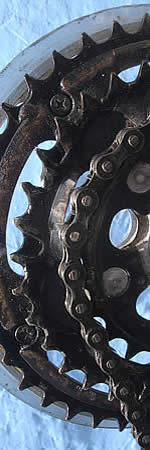
Breakdowns:
04: broken spoke (Son)
16: ot workig o keyboard otebook... !! *
20: eyelet broken and welded (Son)
24: flat (Ali)
25: 2 broken spokes (Ali)
30: flat (Son), spoke (Ali)... never ending story... (see July...)
* the 'n' was not working anymore...