

Country information: USA
On the road . September 2008 . United States (Washington, Oregon & California)

Molly's
Apartment , Oakland, California, USA, 29-09-08
From the hippies on the lake (Nelson-Canada)
to the hippies by the sea (Astoria-USA): 14 cycle days;
1072km; 9766m
Part 2: near Ellensburg to Fort Stevens: 6 cycle days;
489km; 4347m
Ellensburg to Selah (40 km; 263 m)
Selah to Rimrock Lake (75 km; 674 m)
Rimrock Lake to
near Randle on NF25 (100 km; 975 m)
near Randle to Cougar (86 km; 1076 m)
Cougar to near Clatskanie (109 km; 785 m)
near Clatskanie to
Fort Stevens (79 km; 574 m)
What a welcome indeed
Rising late, we amply dawdle over a breakfast of fried
onions, tomatoes and melted cheese on wholemeal pita,
finished off with black coffee and a few peanut granola
bars. One of the best parts about cycling hard each
day: you can eat just about anything you want and you
don't put on weight. It's when you stop that you really
have to watch it. Then you tend to want to go on gorging
on high energy food for at least three subsequent days.
The canyon road leading into Yakima is a must-do cycle route. Totally dramatic scenes and a tailwind to ease you up and over the couple of hills you will encounter. I have to say, this is one of the best day trips we have ever done. You follow a raging river and railway for most of the journey winding along a ravine surrounded by barren brown basalt rock formed over 20 million years of magma eruptions and flow. This 518,000 km² (200,000 mi²) area expanses Washington, Oregon and Idaho and is believed to be one of the largest lava fields in the world.
As we cycle to the top of the last hill before plummeting down into sweet smelling apple orchards, we meet Brad cycling in the other direction. We had rung him yesterday from Ellensburg to say we were on our way and would like to take him up on his offer of a place to stay. And what a wonderful welcome indeed: a hot shower, a comfortable nights sleep in a campervan with a television and wifi connection, plus a great meal shared with an especially vibrant family in Selah (40km; 263m). Talk about luxury!
Next morning, Brad cycles to the outskirts of town with us and here, we part ways. He is almost as passionate about what we are doing as we are and although we consider ourselves lucky to have met such a generous person, he insists it is his pleasure for being able to share just a small part of our adventures.
Pedalling down the Naches Highway, past rows and rows of apple and pear filled boughs, we both remark on what a delightful time we are having in the US. Even at the Starbucks outside Fred Meyer, where I stocked up on a few supplies earlier this morning, an overly-keen local shouted us a couple of coffees. A little further down the road at a fruit and veggie stall, an old man chats agreeably with us about our tour and relays his adventures fishing for black cod in Prudhoe Bay, Alaska. Tomorrow a woman will get goose bumps as we tell her our story and she'll extensively relay her recent travel experiences in North America. A week down the track, a passenger will clap her hands excitedly, as the car she is in overtakes us. People are simply not scared to share their thoughts with you and their enthusiasm for what we are doing, is truly touching.
Yet another beautiful spot
It is a very gradual ascent today; we hardly notice
the 1% average climb at all. There are plenty of opportunities
to camp in the Wenatchee National
Forest campgrounds but they are asking between $17
and $19 per night for a site, which is incredibly steep
for the most basic facilities you can imagine. The parkland
and surrounding areas are beautiful and it is a glorious
ride. Sun is out and skies are blue. The only thing
that spoils it are the logging trucks and corn filled
semis, who don't slow down or stop for anything. We
trundle our way on up on pretty small shoulders most
of the time until we hit a tunnel, but not before stopping
at the Rimrock Grocery Store. It's pricey, however the
only supply-spot until Packwood and to their credit,
they pretty well have everything you need. Rimrock
Lake (75km; 674m) is a few kilometres
further on and we discover a small access road leading
shore side. Though the area is in a total mess, it's
a gorgeous view of the lake, so a good part of the afternoon
is spent cleaning up the place. We collect about 10
kilograms in broken glass and empty bottles, which is
carried out with us the next day and deposited in one
of the park's dumpsters a mile or two up the road. For
the life of me, I still cannot fathom the mentality
of people that leave glass behind on a beach. Even the
tiniest amount of logic should tell you that it's an
inconsiderate and stupid thing to do.
Piece of Cake
Expecting some hard work today, we leave energy charged
and rearing to go, only to breeze over White Pass
(1372m) with very little effort at all. More
exertion went into Ali picking himself up off the gravel
after one of his circular turn maneuvers fails and he
lands himself a cropper on the tarmac. Not too much
damage and hardly any blood. From here on in, it's a
truly magnificent drop into Packwood. Another spectacular
day and Mount Rainier (4392m) is in perfect view as
we spiral our way down the other side of the pass. It
somewhat resembles a giant Christmas pudding that has
shot up to a height of nearly 5 kilometres with a summit
that someone has smothered generously with creamy white
frosting. This tallest peak in the Cascade Range is
quite the visual delight. Packwood, on the other hand
isn't and from what we can tell, seems to be full of
a bunch of weirdoes. Still, we only need to shop here
and not take up residency.
We storm out as quickly as we flew in, though we are tackling a strong afternoon headwind by this stage. Thank goodness it is almost flat the whole way to Randle. Just on the outskirts of Packwood, a visitors info booth had a number of pamphlets of interest to us. The one with information on camping outside of campgrounds was a revelation in itself. Gosh, they actually promote this stuff here: how open-minded of the National Park system. Unfortunately the other, a detailed map (pdf file: 1.57Mb) of our route through Gifford Pinchot National Forest, had some bad news. Apparently, the bridge near Iron Creek is closed for repairs. In Randle, we stop at the Rangers office to get more facts, but arrive just five minutes too late. They closed at 4.30pm. We desperately sift through the mountains of information pinned to walls and display boards, but to no avail. We can't find out anymore about this closed road. After 10 minutes or so, a ranger pulls up and alleviates all our worries with the news that we can still cross the river.
Completely in the thick
of it
And so off we happily set, along Forest Road 25 towards
tonight's destination. Sounds simple enough, doesn't
it? Especially when you know you've only got 10 miles
or so to go. Well, attitudes change when your immediate
entry into the park begins with solidly traversing very
steep inclines for a little over 3 kilometres (2 miles).
Then, you begin to think nightfall will come a little
sooner than you'd like. Luckily, it flattens off after
a short, but triumphant downhill patch and we roll into
Iron Creek Campground around 6pm.
Disappointingly, we discover they want $19 a night for a totally primitive plot. But hey, not to worry, we can camp anywhere in this National Park: the brochure said so. And off we set again. This time the uphill onslaught is unremitting and it's a sheer drop on the left and massive slope towards heaven on the right. To make matters worse, every time, which is not very often, we spy a portion of land suitable for camping on, we are confronted with a Private Property or No Camping sign. What's the point of offering the option of camping anywhere, when the terrain is so totally inappropriate for pitching a tent?
We are not particularly happy by the time 7pm rolls around and we still haven't found a decent spot. Ali thinks we should park ourselves in the picnic area, which clearly states that camping is not allowed. It is also way too close to Iron Creek campground and I would rather not. This conflict in ideas of course, leads to a lot of swearing and words flying around that, quite honestly only come out when you are tired, hungry, stressed and have different thoughts on how to solve the problem. After I chuck a huge wobbly on the side of the road at the 9 mile road marker, Ali decides he'll follow me up the hill and we keep on pedalling as the mist closes in on us. It takes us a further 20 minutes before we settle for an overgrown access road, which shoots off to a piece of moss and fern covered ground, just big enough to fit our tent in, South of Randle on NF25 (100km; 975m). It's an obstacle course getting the bikes over dead wood and ditches. It's damp and we are both cold with sweat. A wet-ones tissue bath is in order tonight, as there is no water source close-by and we need all our supplies for cooking dinner and our morning coffee. Gee...coffee or a bath, now which would you choose?
Destination: Cougar
We are using the standard Washington
State Highway map (pdf file: 3.5Mb) as
our guide, supplemented with any other detailed maps
supplied at most tourist information booths. Some are
manned shacks, some are real offices and others are
just an erected stand in a parking lot off the highway.
Nonetheless, the availability of facts and figures in
the US is insurmountable, highly accessible and greatly
appreciated by a couple of cyclists meandering their
way around the country. For more information on
highways and web interactive maps see the Washington
State Highway website.
After the 17 mile marker, a few wild-campsites come into view, though they are few and far between, making that "camping outside of campgrounds" pamphlet a complete laughing stock. An altitude of 540 metres takes us exactly 1¾ hours to complete before a well earned energy fix of bagels smeared in peanut paste and topped with sliced bananas, granola bars and a couple of handfuls of trail mix. Elk Pass (1244m) is a further 41 minutes away and amounts to a total of 670 altimetres of climbing over 37 kilometres (23 mi) . It's steep in parts but not too difficult, but certainly what you'd call a good mornings workout. We go down before having to climb up again to Mt St Helens Viewpoint.
The signage here is old and outdated and just 100 metres up the road you'll get a much better view of the still recovering valley and volcano walls. On May 18, 1980, Mount St Helens erupted causing an earthquake of 5.1 on the Richter scale. The eruption lasted a total of 9 hours and a vertical upsurge of ash rose 24 kms high above the crater. Mount St Helen's height actually dropped nearly 400 metres during the catastrophe, but probably the most destructive statistics come from the lateral blasts of hot rock and ash which killed trees up to 27kms north of the volcano: during the first 10 minutes of the disaster, close to 600km² (230 mi²) of forest was destroyed or concealed under volcanic debris. They are pretty phenomenal stats.
The ride down to Lewis Creek can only be described as an exhilarating corkscrew affair with Ali twirling a lot faster than me of course. From then on in, the road along Swift Reservoir is up and down like a well-spun yo yo. From the abundance of No Trespassing, Private Property and Keep Out signs, there is absolutely nowhere to camp except for the Pacificorp Campgrounds set up along the way. The list of rules and regulations as long as your arm posted at their entrances result in us refusing to go anywhere near their establishments. As we cross over the dammed area of the reservoir just before Cougar (86km; 1076m), we stumble upon Lone Fir Resort. The reasonable rate of $15 per night for a green grassy site, wifi connection and piping hot showers is certainly okay by us after a hard day of climbing. We even treat ourselves to a few episodes of "My name is Earl" before shut-eye tonight.
What is it with them shoes?
Highway 503 is a stunning ride: woodlands,
rolling hills, farmland, quaint farm cottages, up and
down, down and up: you couldn't ask for more rural variety.
It ends abruptly though when we pop out onto Interstate
No 5. Then the leisurely ride turns into a head down
and bum up event. Even though we face a strong headwind,
we still manage a 25km/hour ride due to the traffic's
suction factor. I reckon there is enough vacuum power
here to energise the full compliment of Hyatt Hotel's
hoovers in Los Angeles alone. Not only that, but the
amount of corn on the cob lying roadside could feed
a family of five for a week. I'm tempted to stop and
pick some up, but that's way more scary than keeping
the pedal rhythm happening.
One small thing that I just don't get, is the amount of abandoned shoes on the highway. I mean, how do you lose just one shoe? Are you travelling with your foot hanging out the window when a wind pocket suddenly rips your clodhopper off? Or, is it a rotten big sisters' trick to exit one piece of her younger sibling's footwear. Now, a pair of shoes, I could comprehend: fallen off the back of a truck, but just one, baffles me entirely. My thoughts don't remain too long on this unproductive wavelength as a support-tyre from a logging truck unwedges itself from under a tonne of tree trunks and comes bounding on down in our direction. Luckily, the runaway rubber is redirected by a couple of unsuspecting cars and it's course maneuvered out of our path. But this then gets me looking at all the junk lying on the shoulder. I get a little more worried about the odd bits of wood and bark lying on the shoulder. Some of those pieces could do some pretty major damage if hurtled towards you.
Before the traffic suction could get the better of me, we side-road it into Kalama. A lunch stop follows and then it is a decent climb out and around the Interstate on Old Highway 99. A couple of Harley riders give us the thumbs up for choosing this route. It certainly saves us a bit of extra stress, but before too long, we find ourselves back in the middle of freeway mayhem.
A bridge with no room
Longview is overly-industrialised and not a pretty place
at all, though the curiously chatty supermarket clientelle
make up for this negative aspect. At this point, we
have to cross the Columbia River yet again and traversing
the Lewis and Clark Bridge can be summed up in one horrifyingly
loud shriek of "AARRRGGGHHHH!" Basically,
the shoulder is filled with logging debris, old brake
shoes, blown out tyres and I do mean 'filled' to the
degree that you can no longer see the cement surface
under your wheel. Swerving your way through such an
obstacle course, on a bridge where traffic, with little
regard for your plight, flies past at momentous speed
and where the wind is also working its way high on your
list of things you hate most, doesn't fall under the
category of "leisurely afternoon bike ride".
Over the bridge and we turn onto our next stretch of nightmare: Highway No 30. There are cute little boards marking this length of road as "The Lewis and Clark Trail". While back in 1804, when Meriwether Lewis and William Clark set out on their heroic expedition across the Lousiana Territory, it probably was a trail, but in more recent times, it has become a monster highway with steep, nasty climbs and little or no shoulder against metal railings. It is pretty much clenched teeth the whole way. It is also Friday afternoon, peak-hour and to keep myself from going totally insane, I play a little game. Each time a car passes, I start to calculate the time period until the next one passes. The highest count in a half hour stretch is 15 seconds. Most of the time I just manage to get the "w" sound for the start of "one" out, before I have to start again. If anyone could have heard me over the traffic dim, they might have thought I had a terribly bad stutter. As you can well imagine, this activity doesn't keep me occupied for the entire 24 kilometre ride into Clatskanie (107km; 785m), so I take to singing to try and lift the spirits: it has been a long, hard 9 hour day, with 6½ of those hours on the bike. An RV campsite, where Ali decides we are going to spend the night, backtracks us down a winding country lane for a few extra kilometres. The $20 fee is a little over our budget, but the abundant hot water in the bathrooms and warmth from the open fire are money well spent.
Almost there, Almost 42...
Back on Highway No 30 again for another day. All I can
think about is getting to the Pacific coast and travelling
down that much talked about Highway: The 101, which
will, according to many cyclists accounts, mean not
having to push against gail force winds anymore. Rumor
has it: we'll get blown into San Francisco. Today the
weather is so that it's warm going up and cold going
down, and we still do quite a bit of that, so I'm forever
stopping to take the jacket off and put the damned thing
back on again. Irritating stuff. Probably the most compelling
event of the day is discovering the barking sea lions
at Astoria's wharf area. The place is overrun with these
incredibly vocal chaps all vying for a prime piece of
jetty in the early afternoon sunshine. Also have to
admit that, the fine examples of Victorian architecture
are quite entertaining viewing as well.
There's another bridge to tackle today. Somewhat longer, but not half the drama of yesterday's incident and no where near the distance of the 6½ kilometre Astoria-Megler Bridge, which for cyclists coming from the Washington Coast, is the only way across. Like most afternoons, the wind has picked up but it is just nine more kilometres up the road. Unfortunately, about halfway there, I hear that undesirable pinging sound of a spoke on my back wheel. Yep, cassette side as well. Darn! Darn! Darn! Anyway, when we finally arrive, the Fort Stevens - Warrenton (79km; 574m) campground is completely booked out. Good news is, it may be full for vehicles but not for the Hiker Biker sites. As the name suggests, these camp areas are set aside especially for tourers on bike or foot. In Oregon, the cost is $4 per person and you have unlimited use of the shower facilities. Fort Stevens is quite nicely set out too, with individual fire pits and picnic tables in numbered sites. Another bonus is the nearby toilets, which in hindsight, we should have appreciated more. A down side is the cheeky raccoons who just love to make a racket at night, sneak past your tent and nibble on your food.
We take a couple of days off here: a well earned rest after 14 straight days on the road. The next morning, Ali awakes to a couple of candle filled chocolate chip muffins and the surrounding trees adorned with little presents. He unwraps a couple of nice pens, a spiral booklet for his daily note-taking, a new toothbrush, a key ring made out of some driftwood I found at Rimrock Lake and surprisingly enough, there's even a small parcel for me too. Now, I wonder who came up with that sweet gesture? I am so convincingly excited about receiving it, we just laugh until tears are running down our cheeks. Ali is 42 today. Hip hip hooray.
Tonight, the hiker-biker site fills up and it's the first time we have met so many cyclists in one spot since Osh, Kyrgyzstan. The following evening there is a grand total of 12 tourers. Some of them we chat with and others keep to themselves. We spend just enough time at Fort Stevens to celebrate Ali's birthday, plan our trip with the free waterproof Oregon Coast Bike Route Map and update the site to the end of the month of August. Mind you, the last chore is only achieved by hooking up to the electricity supply in the ladies toilet. Luckily, a vent slot is big enough to poke the cord through to the outside, so I can enjoy writing under trees, instead of perched on a toilet seat in a concrete cubicle for hours on end. That's life on the road sometimes you know.
Just one revolution after
the other
Fort Stevens to Oakland: 15 cycle days; 1 rest day;
1345km; 13041m
Fort Stevens to Manzanita (63 km; 626 m)
Manzanita to Netarts (66 km; 410 m)
Netarts to near Newport (102 km; 1019 m)
near Newport to near Florence (100 km; 944 m)
near Florence to near Coos Bay (109 km; 809 m)
near Coos Bay to near Port Orford (99 km; 911 m)
near Port Orford to Brookings (83 km; 919 m)
Brookings to near Orick (103 km; 954 m)
near Orick to near Trinidad (38 km; 357 m)
near Trinidad to
near Weott (127 km; 704 m)
near Weott to near Leggett (73 km; 849 m)
near Leggett to near Mendocino (94 km; 1207 m)
near Mendocino to near Fort Ross (112 km; 1380 m)
near Fort Ross to near Olema (108 km; 1408 m)
near Olema to Oakland (68 km; 544 m)
Now, before I get on with the daily blurb,
I have to set a few records straight. Anyone that tells
you that Highway 101 has good cycling conditions is
lying because they have either plain forgotten about
all the near misses with logging trucks, or they have
never actually cycled it themselves. The myth about
wide shoulders? Utter bollocks. Good roads? Errrrhhhnnn!
Wrong. Tailwind the whole way? Uuh uuh, wrong again.
On a positive note and to compensate for the more often than not, unsafe riding environment, you'll be entertained all the way from Astoria to Brookings with an ever-changing terrain. The diverse 580 odd kilometres of road dishes up perfectly stunning views of not only pristine beaches with snowcapped surf, contorted cliff faces and curious rocky protrusions, but also luscious green rain forest that somehow transforms itself into a landscape of wind swept desert dunes. You'll wind your way past historic milestones, through charming little towns, over legendary rivers with dramatic bridges and along some of the most picturesque coastal scenery you'll ever get the chance to experience. And coming from an Australian, who thinks the beaches in Oz are pretty damned good, that's definitely saying something.
In addition to the breathtaking scenery, the hiker-biker facilities are excellent value at $4 per person and a general feel-good atmosphere can't help but be created with everyone cycling the same route together. At the end of the day, most groups travel roughly the same distances, end up in the same campsite and over a beer by the campfire you get to know everyone on a first name basis. But what makes our trip so special, is that a small group of us, with ages ranging from 20 years through to 56, band together to cycle down the Oregon Coast. No-one planned it, no-one even mentioned it, it just happened and we have never laughed so much in all our lives. Most of that credit has to go to Jim. But I'll introduce you to him a little bit further on in the story. First, we have to meet another Jim.
Two Jims in one day
Like I mentioned above, the first day
of cycling the 101 is a bit of a shock. Putting up "bike
route" signposts doesn't necessarily make the terrain
a decent cycle passage. I suppose, coming from Europe,
and especially The Netherlands, we are a bit spoilt.
But really, how can less than one inch of shoulder be
classified as part of a bike route? And especially on
one so celebrated as the Oregon Pacific Coast Scenic
Byway: whew that's a mouthful. Still, we are quite
inquisitive about the imminent Arch Cape Tunnel after
the 'a little too touristy for us' township of Cannon
Beach.
As stated in one of the many free booklets and pamphlets obtainable from any visitors information centre along the way, the tunnels along the way, have a flashing light system especially for cyclists. When you near the entrance, you push a button and a light flashes above the concrete construction, warning vehicles to slow down to a speed of 30 miles per hour, because a cyclist is up front and enroute. Now in principle, this should work, but disappointingly so, it does not. Trucks and RV's zoom past like there's no tomorrow and so the only resort is to pull over and take up way too much of the lane, which means they have to sit behind you for the entire uphill saunter. Serves most of them right!
We actually spy Jim up front of us, but I stop just outside the tunnel to shed some clothing. It's a beautiful summery day. We lose sight of him after that and besides, he's the Jim I'm supposed to be telling you about later on in the story, not now. But while I'm at it, he has a rather undisciplined gray beard and matching mob of long ponytailed hair. He's wearing a fluoro yellow vest, baggy beige knee-length shorts and almost gets wiped out by a truck towards the end of the tunnel. It is probably not the first time this has happened and it will definitely not be the last.
Just before Manzanita, we stop at one of the viewpoints to marvel the sheer cliff face drop into an endless expanse of coastline. The Jim I'm supposed to be introducing you to, just comes straight on up and gets chatting with us. By his own admission, he's a big boy and talks a lot about wanting to go touring on a bike. To get fit and loose weight. He enthusiastically picks our brains about why, where, what and how and I don't know, but maybe we help him get one step further to his goal. I hope so, still, whether this be the case or not, he is insistent that we stop by his campervan for one of his famous smoothies. It is agreed and we set off towards town. As we are just about to leave the local store, we meet Jim once again, who by this time has driven to Nehalem Bay State Park - Manzanita (63km; 626m) found a site by the beach and dropped off his trailer. This time round he offers us space on his site, but in truth we'd like to check out the hiker-biker area first. Upon arrival, we opt for the latter.
This is where I meet Jim. Gosh, this is confusing, so I'm not even going to tell you about the other Jim we met the day before at Fort Stevens. Anyway, I'm pushing my bike around this fellow with the wild hair and yellow vest's tent and say "hello", as you do. Before you know it, it's half an hour later, Ali has our tent standing, with all the gear set out and is ready to crack open a cold beer. During this time Jim has compared every element of my bike with his and he is dead set he wants one like mine. When he gets wind of the fact we've travelled around 16,000 miles to date, there's no stopping his admiration for our adventures "Man you guys are real pros!"
And one more makes three
By the time dusk begins, the rest of the cycling crew
from Fort Stevens have all come pedalling in: one by
one and in dribs and drabs. Only Tim
and Cindy Travis have stayed behind. These guys
have been on the road for 6 years now (thumbs up) and
written a couple of books (where did they find the time
for that?)
Paul pulls in too. He also knows the Travises from a recent tour in New Zealand. This Englishman has been cycle tripping, more on than off, over the last few years and on a fold-up bike, which mind you is fully loaded. As we make our way to the camp exit the next morning, after a super energising breakfast of oatmeal and fruit smoothies at Jim's campervan, Paul is pulling out. And so the three of us venture on together along the 101 towards the famous dairy and cheese factory of Tillamook. There are a couple of decent climbs but nothing too strenuous and for some of the way we ride flat along marshy wetlands glistening in the morning sun.
There is a choice of following two alternative routes after Tillamook, which any cyclist in their right mind would do. Anything to get off the highway. The turnoff takes you onto Bayocean road and from here you have the choice to follow it around the Three Capes Scenic route, which according to the guide is pretty spectacular but also extremely steep and adds another 16 kilometres to the journey. It's 2pm and so we choose the easiest option along Netarts Hwy, though in hindsight the coastal journey would have been do-able. Still, it is nice to arrive at the Hiker-Biker area at Cape Lookout State Park - Netarts (66km; 410m), with plenty of afternoon hours to wander around. It is in a beautiful forest setting right on the beachfront, with a few too many mosquitoes for most campers liking.
We are the first to arrive, followed close behind by Jim in the iridescent yellow vest and Ben with canary yellow Ortlieb Back Rollers. Jeff rocks in soon after that as well. Like a madman, he cycled from Fort Stevens to here in one day and has blue Ortliebs that are just a little darker than the one's Paul is carrying. Jim glides in an hour later. No I'm not going mad. This is the other Jim I was talking about earlier on in the piece, also from Fort Stevens. His Ortliebs are black and he has to return to Portland tomorrow. In a way, he's doing me a favour by making this story a little less confusing, because now all we are left with is 56 year old Jim, later crowned Chief. And one Jim on the road is enough. By the way he doesn't have Ortlieb bags at all, which we will hear about for many days to come.
(2)+2=(4)+2=(6)
The mist is hanging low this morning and over my second
cup of coffee, I am spellbound by the sunlight filtering
through the pines and onto a dew dropped cobweb. I admire
it for so long that by the time it registers that this
would be a good photo, the sunlight has moved and the
angle lost. A vibrant blue jay then becomes my centre
of attention as he circles each site, looking for any
leftover food. They are a beautiful looking bird, with
distinctive blue shades, ornate black and white markings
and a stylish crest to top it all off. Most people find
them irritating, due to their bold and definitely cheeky
nature and they are believed to steal eggs and nestlings
from some of the rarer coastal species. I still find
them fascinating.
Everyone seems to have taken off well before us this morning and so we stroll out of the park as a couple. But, not even a kilometre up the road at an historical surveying viewpoint, Paul and Jeff round the bend and the team immediately doubles. As we tumble down from luscious forest growth towards Sandlake Road we abruptly find ourselves in an expanse of sandy dunes and this first day of real warmth in a number of weeks is quite fitting weather for such desolate surroundings. We reach Pacific City by 11.15am, but decide it would be best to cycle a further 10 mile up the road to Neskowin. The ride is dead easy.
Well and truly before we pull up onto the grassed area outside the general store, we can spy the dazzling yellow from both Ben and Jim's cycling gear. They are just finishing their lunch and while Ben thumbs through a USA Today for any sports news he can find, Jim has time to scrutinize our eating habits with great interest. As well as praising my knife skills while I compile three avocado, cheese, tomato, onion and mayo sandwiches, he finds the cotton tea towel spread on the grass like a picnic cloth a total winner. "Wow! You guys think of everything" he says. Just as many bag-loads of banter fly around as calories are consumed, before we all pack up and unwittingly trundle off in a six strong procession.
Just what a PR man can
do
Turns out to be a fun packed day of cycling,
even though the terrain is pretty tough. Especially
so for Jim, who at 56 has turned his life around, bought
a touring bike and all the gear and decided to tackle
one very challenging cycle route indeed. The alternative
passage along Slab Creek Road is supposedly gentler
gradients but it is still tough pushing. Coming down
the other side, whizzing past old-growth forests and
farm land is a sheer delight. It's almost heart-breaking
to turn-up at the main drag T-junction, which leads
us, along with way too many other vehicles, into Lincoln.
Getting six people in and out of a chain supermarket and back on the bikes takes a bit of co-ordination. Jim works like a magnet to people and anyone that so much as blinks within a 100 metre radius of us gets the details straight up: "Sixteen thousand miles and two years on the road. Man these guys are real pros!" It's like having your own personal PR Man touring with you. Needless to say, we hand out plenty of business cards on this leg of our trip and have conversations with strangers that we probably never would have spoken to.
There's still a fair distance to cover before our preferred destination just north of Newport and some leg-crunching climbing as well. The Otter Crest Loop side route perching us high up on the windy coastal rim all the way to Cape Foulweather Lookout is a visual delight. The one-way lane with separate bike path especially quaint, but we all agree that the drop back down again is magnificent. Every time you get to glimpse at the landscape in front of you, it has changed. From forest sidling up along sheer craggy cliff faces to sand dunes edging grassy swampland. It's all totally aauuwesome; sorry about the lingo, but when in Rome, speak like a Roman.
On the other hand, there's not too much to get excited about regarding the hiker-biker area at Beverly Beach State Park- near Newport (102km; 1019m). The non-motorised travellers (12 of us in total) are crowded into a small uneven area tucked away on the far corner of the park and up a hill that leads to the rv dump station. Shower facilities are almost a packed lunch and water-bag hike away and get the thumbs down from me, which means Ben won't have a shower tonight. Like myself, he likes to hang under the jets of almost scolding water until his skin has turned a perfect lobster pink. Anything less, and it results in unbearable grumpiness.
Thank goodness, we do have two portaloos at our disposal, but here's the really weird thing, one of them is a disabled access toilet. Forgive my assumption, but at a guess there are not too many hiker-bikers actively enjoying the Oregon Coast who are confined to a wheelchair, and even if there were, how in the dickens are they supposed to traverse the hill leading to the toilet anyway. The only benefit of such ample room around this molded plastic chamber pot is a you could use it to get changed in. Personally, I'd rather get cramped in the tent; they are pretty smelly places to hang around in.
As darkness ascends and the glow of LED headlights dot our campsite, it is high time for everyone to relax. Tonight, warm food tastes really good and sleep is more than welcome, but not before Jim relays one of his favourite recipes and tells Aaldrik for possibly the tenth time today, that he looks like his old friend Doug Austin. That's Doug Austin as in the brother of the famous tennis player Tracy Austin, who had to give up her career due to a sciatic nerve problem. He's also brother-in-law to Denise Austin, an American fitness and exercise expert, who once upon a time could be seen every weekday morning on Lifetime TV. She's married to Doug's older brother, Jeff, who also happened to be a professional tennis player. I can't remember his wife's name, but she's known for something as well. Jim used to hang-out with Doug quite a bit and apparently, in his hey-day, Doug used to get all the girls. Now he is the vice-president of JCC Homes, a LA based business. And just in case you have already forgotten, he looks just like Aaldrik.
But without further ado, the moment you all have been waiting for:
 Jim's food tip of
the day:
Jim's food tip of
the day:
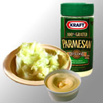
Fresh steamed cabbage with
fake butter and processed parmesan
Over steamed cabbage,
Jim jubilantly announces: "I could
eat that stuff everyday!"
Unfortunately, his unbridled enthusiasm
while communicating this easy recipe to
us, doesn't quite translate well into
words. But, putting it simply:
steam the cabbage and when it is ready,
smear on a good portion of butter, the imitation
stuff of course and then dump loads of parmesan
on top.
As
an added thought, Jim recommends trying
it with broccoli though he's hasn't actually
tried that recipe himself yet. But he will
because you can purchase a really big bag
of fresh broccoli at Costco's for next to
nothing.
One man out...
Full on headwinds today as we ride along
far-reaching stretches of white sandy beach covered
after every ocean ebb with an aftermath of tumbling
frothy surf. Paul leaves the group at Newport Bridge
to head inland towards Albany, in search of three out
of print Science Fiction essays. They apparently have
a specialist bookshop there. Though my quest is not
so unique, it's as equally urgent: I need to find a
bike shop to pick up a new tyre for my back wheel. Our
Schwalbe Marathons just don't seem to be living up to
the job anymore. They began to show signs of wear after
just 4000 kilometres, which is the lowest mileage we
have ever got from them. While the rest of the crew
and myself take the Newport bypass, Ali hits the highway
in search of a cheap tyre: the most inexpensive he can
find is $20: we'll see how this one holds out.
Crossing the Yaquina Bay on an arched bridge spanning a total length of just under a kilometre is pretty cruel stuff. Being a bike route, it has the same flashing light system as the tunnels. Being a large group, we draft as best we can, but it is nearly always blowing a gale when crossing waterways and some of us are stronger than the others. What it generally boils down to in this situation is this: each man to himself. This water-passage built by Conde McCullough, who actually engineered most of the bridges we cross along the Oregon Highway 101 route, is quite an architectural splendour. Being an advocate of creating efficient, economical but above all dramatically beautiful bridges Mc Cullough was employed to assist in designing over 600 bridges in his lifetime.
Being a prominent bike route, you would think that the motorised commuters might have a bit of compassion for cyclists. But, there you have it, thinking can sometimes be absolutely futile and, they don't. Being a total ignoramus, one oversized beef-head in his V-8 screams out, "Get on the f***in sidewalk, you f***in idiots" I mean to say, hello??? Firstly: we are most certainly allowed on this bridge, otherwise they wouldn't have installed the warning device for motorists; and secondly: we are most certainly not f***in idiots! Being the vindictive type when on the road, I pull out into the lane and block what ever traffic comes up behind. The other guys in close range do it too, though Jim's 'riding in the middle of the road' technique is not a intentional one. He just has the tendency to drift.
The ride into Waldport proves busy and quite often there is no or little shoulder. We stop a few miles before the town for lunch and Ali logs in to the wifi connection at the general store (not normal) to upload last months data. We might be in a first world country, but still, electricity, internet connection and all those modern global conveniences you take for granted when you have a home base, are difficult to access when on the road. What isn't difficult to find, is fast food and Ben epitomises the 'All American Food Dream' by ordering pizza and icecream at the same time. To our total amazement he actually consumes them both at the same time as well.
...coasting the coast...
From here we pass through Yachats and then up a small
climb to Cape Perpetua. The undulating roadway together
with the rough and rugged coastline could be likened
to the Great Ocean Road in Oz. In fact, throughout the
whole trip so far on the Oregon Coast, I see lots of
similarities with the Australian seaside. The advantage
here being, that resemblances to Esperance (WA); Margaret
River (WA); Geraldton through to Canarvon (WA); Broome
(WA); the fore mentioned Great Ocean Road (VIC); and
Cape Tribulation (QLD), just to name a few of my favourite,
are all compacted into under 600 kilometres. Gosh, I'd
hate to think how much road you'd need to travel to
visit the places I have cited above.
It's a pretty decent workout as we rise in blustery conditions towards the foggy peak at Heceta Head, where we can add the scary event of passing through Cape Creek Tunnel to our list of accomplishments today. The problem with climbing on a loaded bike is, you require room for manoeuvrability: you tend to swing the handle bars from side to side to get the momentum happening. So, in order to claim your space in havens for motorised madness, you have to take up enough lane, so those behind cannot pass. It's either that or combat the feeling of constantly being pushed against the tunnel wall, metal railing, raised footpath, whatever. Just make sure you're wearing bright clothes.
The wind has been pretty strong all day and at some points we are travelling in the perfect direction and pick up to speeds of 33 km/ hour on the flat. Our average daily speed of 18.7 km/hour is testimony to that. It's a record speed for us, if you consider the hilly nature of the terrain. There must have been quite a bit of fast pedalling going on today. The marvelous drop over 12 miles into Florence is just one of those excellent coasts. Here, we shop before continuing on a further few miles of ascent to Jessie M Honeyman State Park - near Florence (100km; 944m).
If it is at all possible, the camp area is even smaller than last night and there are a lot of cyclists, all contending for a flat bit of earth and table space. There are two fire pits in close proximity and one water-tap. Toilets and showers are a 5 minute dawdle away. By now, we know pretty much all of the crew that are travelling at the same pace as us. There's our gang of five and another more hip clan of six, who are actually two groups of three. Every now and again a couple of them drop off and do their own thing, but tonight, they are the full compliment. Then there is Dick, who likes a micro brewery beer or two, but we haven't actually seen him since Fort Stevens and Glen, a Canadian that has a bad habit of smoking cigars first thing in the morning while downing his organic yoghurt. Last, but no-way least there is this girl, whose name escapes me (Jeff will know) and who not only is in an All Stars Roller Derby Team, but can pedal like a speeding bullet. There are three others we don't know: a couple of young lads, who have sadly lost their tent fly while cycling in the stormy conditions on the coast and a bit of a strange character on a old heavy framed bike you would normally only use to hack around town in. Jim lends the young boys a spare tarp because Jim has two of everything stashed in his bags, but the old chap just passes us all at regular intervals, wheeling his bike with him every time, and doesn't say a thing.
Round the picnic table tonight, Jim suddenly has cravings for BBQ chicken and consequently enthusiastically enlightens us with his culinary wisdom in this area. I thought we should share it with you too.
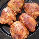 Jim's food tip of the day:
BBQ chicken thighs
Jim's food tip of the day:
BBQ chicken thighs
First place chicken thighs bone side down on the BBQ and cook for 30 minutes. Turn over and continue cooking meat side down for another 30 minutes. Brush with BBQ sauce and keep on the heat for 10 minutes.
Jim has a strong aversion to dry meat, so he guarantees that if you use thighs with the method above and not other chicken portions, the meat will stay beautifully moist and will simply fall from the bone.
One area that Jim is not too sure about is barbecuing salmon. I promise him I'll show him how, when we get to Laguna Beach, though because I'm vegetarian, he'll have to do all the cooking himself.
...and almost two down
The journey is hard work again to day,
but a steady tailwind helps us along. Especially up
the incredibly steep inclines of Lighthouse Road and
back onto the main drag. Initially, we miss the turn-off
at Winchester Bay to this alternative route and pleasantly
find ourselves hurtling along coastal dunes, only to,
unfortunately, finish off in a car park and at the end
of the road. Then we find out exactly how strong the
force of the gale is today. This area is inundated with
ATV's and cross country bikes, which also means an over
abundance of RV's, trailers and anything big on wheels
really. Jim certainly let's us know that he despises
quad bikes and admittedly it's not the type of place
I'd want to hang out in. Ben sort of agrees, but he
does think hooting down a massive sand-dune looks like
a lot of fun.
Highway 101 stinks: At mile marker 226, at 2.55pm on Saturday 13 September, a south bound Safeway's Truck comes careering up from behind. Every one of us has some sort of gaudy bright colour attached in some way to our person. We stick out like sore thumbs and yet, instead of slowing down, he increases speed, he doesn't move over and he honks his horn aggressively as he is right on top of us. Right at this point, Ben's handle bar is level with the shoulder line, either swerving the copious amounts of glass or just blown there by the heavy wind. He nearly wipes Ben out completely and he comes dangerously close to the rest of us. The speed limit here is 55 miles per hour. He is way, way over it.
Coos Bay Bridge, known after his death as the Conde B. McCullough Memorial Bridge, is a 1.6 km long cantilever structure and while it might make a beautiful snapshot, it doesn't make for a very pleasant bike ride. We are abused and honked at and once again the stress levels rise. It requires a lot of both physical and mental effort to make it to the other side. Honestly, I breath a sigh of relief when the ordeal is over. It takes the wind right out of Jim and at the first set of traffic lights after crossing, he completely looses his balance and falls across the curb and into a flowerbed. He's a little shaken up and annoyingly so, one of the mounts on his front panniers is completely snapped off. Never did like the look of those Novara bags. Ali straps the thing to the back of his bike and we all make a mad dash to the Safeway store.
The road towards Cape Arago is heavy with broken glass and as we near our destination also becomes thick with clammy fog . Something else in the air tells me, we have moved into parts where the IQ has dropped several points below average. The ride never seems like it is going to end and even after crossing the small bridge at Charleston, there are 2 more miles to go and uphill for a good part of it. The up-down monotony is wearing a little thin. We all just want to get there!
Unfortunately, the hiker-biker area, at Sunset Bay State Park (109km; 809m), is really poor, but showers are okay and it is super cosy with everyone from last night together again and around one fire pit and Jeff actually buys some proper firewood. Not only is this a guy a total food-snob, which, for those of you not familiar with the term, is a good thing, but he knows a thing or two about ambience. Tonight, we also meet a couple of French travellers Sara and Sebastien, who are moving North to South through the Americas.
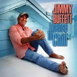 Jim's hot music tip
today:
Jim's hot music tip
today:
Need something good to listen to?
Then Jim says there's no-one better that Jimmy
Buffet.
To start you off: a couple of really good numbers
to enjoy are
Margaritaville and Cheeseburger in Paradise.
And just so you know: Jim's music taste is not just limited to the country/folk genre. He is most definitely a fan of The Dead as well. That's, The Grateful Dead and he proudly tells us several times he saw them in concert in the late 60's with just 150 people in the audience.
Why didn't anyone tell
me about the second gear sooner?
After a strenuous morning of continual ups and downs,
sunshine and fog, hot and cold, we stop in Bandon for
lunch. Fish and chips are on Jim and Ben's menu and
the rest of us opt for just the bag of chips. They are
really good and it's no wonder the seagulls here are
the size of ducks. A quick trip to the sweetie shop,
where Jim is once again in his element tasting all the
samples. Some of the flavours were delicious, some not,
and a few were just plain weird, like the cheese fudge
for example. The prices were steep, but it is a cottage
industry shop and they have to pay for all the give-a-ways
somehow, especially with a bunch of energy loving cyclists
wandering around their shop. Jim comes out grinning
like a cheshire, swearing he must have eaten at least
a pound of candy. Still, the boys see the need to rise
the blood sugar levels even more by eating an icecream
before hitting the road again.
Bike route signage is totally confusing today, but we end up making it back onto the infamous 101 after the Bandon bypass, though a little sooner than expected. The map also seems to imply that it'll be pretty easy riding, however we still seem to rise and fall quite a lot over the whole distance and the last hill before the campground is a killer. Sometimes I will, but mostly Ali sits back with Jim on the difficult terrain. Apart from pleading with him constantly, to move back over to the right, he doesn't use his gears to their fullest. In fact, he sits on the smallest chainwheel, even when going downhill. Though, since you can coast to the bottom of a hill, it's probably the least efficient on the flatter stretches. Basically, the smaller (lower) the gear the less the resistance and this results in what I call windy pedalling: basically, you make more wind than distance. Today, somehow, after many attempts mind you, we miraculously convince him to shift to his middle chainring and man, there was absolutely no stopping him. While we are still ambling along and least expect it, he flies past yelling "Why didn't anyone tell me about the second gear sooner?"
And it's a good thing too that Jim got a bit more power behind him, because it was a long enough day in the saddle as it was. We are all completely knackered when we get into Humbug Mountain State Park near Port Orford (99km;911m) just before dusk begins. It's a great set-up: tiered platforms with tables and fire pits in each site, it's crowded, but comfortable, showers are good and not too far away, and there are plenty of delicious berries to feast on and collect. Cue: Brian enters the scene. He's travelling down to LA and has hitched up with Sue and Dave, a couple of Canadians enroute as well. Jim takes quite a shining to Brian and talks incessantly about getting him to join up with us in the following days.
Jim, white side of the
line!
The road is unbelievably busy this morning and there
are a tonne of logging trucks using it. All the traffic
seems incredibly aggressive for some reason. Only ten
miles or so down the road and I stop to take a photo
of the murky swampland to the right of me. I like pictures
like that. Down the road, I spy Jim dangerously drifting
left of the white line. Every time I see this, I feel
so uneasy. The motorists on this stretch are really
quite unforgiving and already today, a red passenger-converted
pick-up purposefully aimed for Jim and came so close
to swiping him. Anyway, I hear a logging truck coming
up from behind and as this thing whizzes past at a violent
speed, I see another one coming from the other direction.
As far as I can judge, it looks like Jim and the two
trucks are all going to cross paths at the same time.
They can't hear me screaming "watch-out",
I'm too far away. My heart stops a beat. Somehow, the
truck on the right manages a quick swerve while the
other takes some shoulder in tow and Jim is still in
tact. But he's so darned lucky! I pedal on up to where
the boys have stopped and really get stuck into him.
"Jim if you ever ride
in the middle of the road again I'm gonna get really,
really nasty. And you haven't seen me when I'm angry
yet. Man, you know you're gonna die if you keep doing
that. Do you hear me? Die! So, forgive me for being
selfish, but I don't particularly want to see someone
get smashed by a truck. So you HAVE to keep on the right
side of the white line. Right?"
I finish my spiel and Jim looks sheepishly at me and
says: "Your husband just balled me out big time
as well"
"Good", I say. "You deserve it.
Jim! Right side of white and no drifting. Okay?"
"Okay", he confirms.
Everyone has been psyching themselves up for the supposedly monster climb out of Gold Beach. Getting there is easy and pleasant enough, as there is an alternative route that runs along an old coast road. I'm cycling up front with Jeff and we've got the whole road to ourselves. One of the first things he says: "If the whole bike route was all like this, it'd be fantastic." You know, I was thinking those exact same words. The wind sculptured trees and rugged coastline remind me of Cornwall, England. The weather is also similar: rather gray and overcast. That also means it's cold.
This road then ejects us out just before the Isaac Lee Patterson Bridge, a concrete arch construction by McCullough. It is only half a kilometre and it's fairly spacey, so easy in comparison with our other efforts. We find a beach access picnic area in town and have lunch. Jim entertains us with his demonstration on how to fold a chilli bean and cheese wrap. He has the wrap and the cheese and he just says we all have to "imagine the beans". It would be nice if we could imagine that it's 10 degrees warmer because right now it's freezing. We all have long bottoms and several top layers on.
The climb isn't half of what we expected. In fact, when Ben and I are at the top, I keep saying that this can't be it. As soon as I see the truck sign with 6% downhill grade, I just have to believe it. It's a pleasure to fly down. The next series of hills are what do it for all of us really. Everyone agrees that they are far steeper and more difficult to climb. Beside, we've all been riding for more than a week straight and so looking forward to having a rest day at Harris Beach State Park - Brookings (83km; 919m). Jim says it's the hardest day, he's ever done. Like the rest of us, he's just really tired. By 8pm, Jims in his tent, fully clothed and starting to snore.
Not having to rise at 6.30am is a real treat and getting all your clothes washed and dried always has a feel-good satisfaction about it. A rest day is fabulous for the soul and so is singing round the campfire. The hiker-biker area at Harris Beach is pretty well set up, though Jim would argue that it's way too difficult to find coming back from the toilets in the dark. Yesterday evening, he spent a good 30 minutes wandering around the campground, completely lost. Consequently, he was not in a particularly good mood when he finally got back and it partly contributed to his early departure last night.
Brian left this morning with Sue and Dave, but we are pretty sure we'll meet up again soon, most likely at Elk Prairie State Park. Jim's happy about that. He also has a great time chatting with another biker who has arrived on the scene: Daniel. Now this guy is one serious cyclist, having recently completed the Paris-Brest-Paris which entails cycling 1200km solid within a maximum time limit of 90 hours. He came in in the top 10% after just 69hours. Now, that's what I call an achievement and he has the thighs to prove it. They are almost as impressive as the redwood trunks we'll see in a couple of days time. Even though he'll have to slow right down (he normally averages 21 km/hour in this terrain), he stills wants to join us for the ride across the stateline. The more the merrier, we say!
For updated information on the Oregon Coastal Route we followed and other bike trips in the state, have a look at the Oregon State Transportation website. There's a tonne of useful information and great maps to download.
Goodbyes are always hard
Excitement is in the air: we'll be crossing the Californian
state line today and it will mark the 600th mile on
Jim's trip. It's also his home territory, which sort
of explains the outrage, when he learns that the Oregon
State Roads Department is working on a section on his
turf. Personally, I figure, as long as they do a good
job, then what does it really matter. Jim simply can't
agree. There's an agricultural inspection post a few
100 metres on, where you have to ditch any fresh fruit
and vegetables you might be carrying. We only found
out about that legislation yesterday, which meant the
painstaking chore of cooking up every bit food we had
on us and I can tell you, that was a lot. Had I known
earlier, I wouldn't have gone so mad in Fred Meyer's
fresh produce department in Brookings. According to
Jim, the reason for this hard-line policy, though coming
from Australia I don't find it quite so radical, is
that back in the 80's, the Californian government became
a bit slack with their agricultural inspections. This
lackadaisical attitude subsequently lead to a major
fruit-fly outbreak that cost the state millions.
Ben and Jeff need to turnoff just after Smith River, a little town that boasts being the Easter Lily capital of the world. At first, I can't work out what the crop is, as the lilies have recently been harvested. What's left behind looks a bit like rows and rows of pineapple tops, but the climate is all wrong for anything like that. Then I realise that the few remaining white flowers look like lilies. A carved wooden sign hanging roadside and welcoming us to Smith River: Easter Lily Capital of the World only confirms it. Interestingly enough, over 95% of all bulbs grown for the world potted Easter Lily market are currently produced by just ten farms in the narrow coastal section from Brookings through to here.
After a few more kilometres of pedalling past farmland and witnessing a decent sized herd of butter-brown elk in open forest, we finally have to say goodbye to Ben and Jeff. It's quite a sad moment really and everyone wishes that the two boys could just keep on going with us. They would have liked to as well, but logistically it wouldn't work out for Jeff who needs to be back in Portland for work in five days time. He did for a moment think about quitting his job. See what a bad influence we are on people. Anyway, we watch them push off inland, while Ali and myself, Jim and Dani continue along the coastal route and via an alternative road taking us right along the gates of Pelican Bay State Prison in Fort Dick. You could say that this joint is California's modern day Alcatraz and home to some of the worst convicted felons in the state. The Bicycling The Pacific Coast by Vicky Spring and Tom Kirkendall warns its readers not to pick up hitch-hikers in this region. Jim reports that this is where Charley spent quite a few years and not one of us would last a second in a place like that. That's Charley as in Charles Manson if you are wondering. I assure Jim, I have no intention of entering a place like Pelican Bay State Prison of my own free will.
A mountain of knowledge
Fort Dick is a strange little town, but Crescent City
even weirder. There are a few too many homeless characters
hanging out at the Food Barn where we pick up our supplies.
The check-out assistant fore-warns me that we are in
for a couple of big hills. The trip so far has been
one massive climb and fall, so I think, what's new?
Crescent City is the last major stop before venturing
into our first Californian State Park. Jim warns us they are complete
crap, but we'll have to wait and see, because we still
have 30 mile of forest roads to contend with: Californian
bike route: Smith River to Orick (pdf file).
There is indeed a monster climb, starting almost immediately
out of town, with very little shoulder and steep inclines.
The traffic is amicable, patiently waiting behind until
the coast is clear and then taking a wide birth when
overtaking. At the top a sign points out the turnoff
to the 200m (600 ft) drop to the Mill Creek Campground.
It is also a sheer plummet downhill from here into Klamath,
but caution makes way for speed as the roads are in
pretty poor condition.
As we cross the Klamath river, Jim shouts out, to no-one in particular: "The mighty Klamath, one of the most important rivers in the US. Goes all the way from the Cascades and empties into the Pacific Ocean" I'm in close enough proximity to hear him and have to marvel at the extent of this man's knowledge and especially, as he totally admits himself, after putting all sorts of things into his body in the early years. All his little snippets of trivia and particularly his experiences of the 60's and 70's keep a smile on our faces for the entire two weeks that we cycle with Jim. Remind me later to tell you about the time he and a bunch of friends were laughing so much as they threw peanuts at the giant squirrels and big as bears in a park near Laguna Beach. Ten points for guessing the name of the drug they were using at the time.
Much better service than
Jim said it would be
The alternative route along the Newton B Drury Parkway
takes us over a smaller hill instead of the 426m (1400ft)
ascend on Highway 101. I stay back with Jim to let Ali
loose with Dani and we are yakking so much that we hardly
notice the climb. Once at the top, this road drops us
down into Elk Prairie State Park near Orick
(103km; 954m) via an amazing redwood forest.
I have no battery power left for my video, so I can't
film any of the massive trunked growth. Shouldn't matter,
because the day after tomorrow, we'll be cycling through
the Avenue of Giants, which are according to some, much
bigger and far more stunning.
Californian State Parks charge $3 per person for hiker-biker sites, which is cheaper than in Oregon, but the catch is you have to pay for your showers. This means two things: 1. each day at the supermarket you have to remember to ask for change; and 2. there is the chance your shower won't work, which happens to me tonight. I'm spewing, because what are you supposed to do when you are standing naked with all your goodies laid out ready to use and your clothes hanging on the hook? Get dressed again, pack up everything up and trundle back to the camp area to get another 50 cents, which I'd have to ask someone else for because we had no more quarters left? I was literally on the verge of tearing the place apart, but after thumping the coin slot a few times, decided instead to wash myself in the basin. At least the water was piping hot. I'm still seething when I get out, so I drop a little note in the payment box asking for a refund on my 50 cents. I didn't really think anyone would give it back, but at least I had vented my anger. Low and behold next morning, the ranger comes around, gives me two quarters and apologises humbly. Wow, that's what I call service.
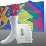 Jim's cycle touring
tip of the day: Don't bring a beach towel or white
socks on the road.
Jim's cycle touring
tip of the day: Don't bring a beach towel or white
socks on the road.
After a week or so, Jim started complaining that his towel wasn't drying properly. It didn't take him long to realise that none of us had bought a beach towel along for the trip. He came over to feel one of our micro fibre bath-towels and said: "I've gotta get me one of those. Where have I been? In the dark ages or something?"
At this stage we also point out that no-one else is wearing white cotton socks either. "Man," says Jim. "You guys think of everything!"
The power of the guidebook
According to the Californian
bike route: Orick to Fernbridge (pdf file) we have a couple of average climbs, but there is only
40 odd kilomtres to complete, so we figure it'll be
an easy day. It's either this plan, camping at Patrick's
Point, or pushing for another 100 plus leg-cruncher.
Also the next hiker-biker campground is 160 kilometres
away at Weott so, we can do with an early arrival and
rest-up for the 120km onslaught tomorrow.
At the Elk Prairie Hiker Biker area, it is 10am. Dani has decided to go for the 100 mile stint and powered out about half an hour ago. I'm sure he'll make it and we are confident this will be the last time we see him. Brian has already left to meet up with Sue and Dave in Eureka: somehow they all got split up yesterday. Hamish and Ida, a New Zealand and Swedish couple have also gone and the party of three: Indy, Amy and Katie, who we have regularly bumped into along the way since Humbug Mountain are just wheeling their bikes out. Everyone will camp at the KOA Campground in Eureka. That's what the Bicycling the Pacific Coast Guidebook recommends. Jim is still not packed and I vow, I'm going to help him compact all that gear down in the next couple of days. His bike looks like an over packed mule.
The ride is simply beautiful, though a lot harder than we anticipated. At one stage we have an unmanned, one-lane road maintenance section, which goes uphill all the way. It takes us two sets of automatic traffic-light sequences to reach the top. Jim found it pretty scary stuff, when the cars were coming in the opposite direction. I didn't consider it too pleasant either, but luckily enough, there were no oversized vehicles for the entire ordeal and enough room for a bit of manoeuvring
Big Lagoon, 11 kilometres (7 mi) north of Trinidad, with it's dense vegetation and shallow freshwater, provides the perfect environment for lots of wildlife. Jim and his mate Phil walked the entire length of the lagoon one day and it's obvious that Jim holds a special place for this area in his heart: "One of the most beautiful spots on the Sunny Californian coastline!" he booms as he pedals past me on the bridge taking a few photos. From here it's just one more climb away from Patricks Point State Park (38km; 357m). This is the spot where his mate Phil also got married.
And it gets our vote as one of the best campgrounds we have visited. Not only are the quaint individual sites in a great setting: all equipped with tables, fire-pits, some even have stone ovens and metal food caches, but the amenities block is right at hand. To top it off, just down the road a few hundred metres you can climb the network of trails on the bluff and peer out over breath-taking ocean views. Watch your step though: it's a sheer drop below. On a clear day, the sunset is particularly special. On any day, you can hear the bark of sea lions lounging around the rugged shoreline.
So, what strikes me as peculiar is the fact that no-one else is here. It's the first campground where this has happened and yet it is by far one of the most gorgeous. All I can say is: the power of the guidebook.
Seen one redwood, seen
them all
We know its going to be a long hard ride today, so we
are on the road by 8.10am. The sun is shining through
the clouds and we hope it stays that way as we wind
our way along Patrick's Point Avenue. We don't actually
enter Trinidad, but instead join back up with the 101.
It's busy, so nothing has changed there. The big downer
is the rain that starts to fall just before Arcata.
We are glad of the shelter at the Californian Welcome
Centre, though not so pleased with the lack of bike
route information. In contrast, Oregon State had it
much more together, with its extensive waterproof coastal
guide. The good news is, we can see a bright patch in
the distance and although it is still a decent drizzle,
we head towards it. An hour later and we are cycling
in the full sun past the sweet scented red gums lining
the highway just before Eureka.
Since Jim is a member of the AAA, he can obtain maps and guides for free, so we cycle away from the Eureka office with a wad of information worth around $40. Next objective: hunt down a good coffee. Dutch Bros is conveniently on the highway and after Jim proudly announces to the guy behind the kiosk, "These guys are from Holland. They've cycled sixteen thousand miles. Been two years on the road. Man these guys are real pros!", we get to raid the free sticker box. They end up being plastered over my Ortlieb bags later that evening.
The ride afterwards kind of goes like this: flat to Fields Landing and then up to Loleta, down to Fernbridge/Ferndale and up again and down too and after Fortuna, where we shop, it is a gradual uphill gradient until the Avenue of the Giants. There is a roadside break just before the last climb to top up energy levels. The redwood forest might be larger in area here, but in all honesty, Elk Prairie is far more impressive. Jim is in fine form in the car park at one of the attractions. Just like a total clown, he is pedalling slowly around in circles in his imaginary big-top declaring "Seen one redwood, seen them all. That's what Reagan said". The three women, who are also admiring the immortal tree, think he's completely bonkers. Doesn't worry Jim, he just keeps it up. "Seen one redwood, seen them all. That's what Reagan said"
And while on the subject of trees and Reagan, he made some other pretty outlandish comments as well. How about: "A tree is a tree. How many more do you have to look at?" Or: "Trees cause more pollution than automobiles do." And just to show that he really had it in for anything green and growing: "Approximately 80% of our air pollution stems from hydrocarbons released by vegetation, so let's not go overboard in setting and enforcing tough emission standards from man-made sources." I actually think that as far as Reagan was concerned, nature was out to victimise him: "I have flown twice over Mt St. Helens out on our west coast. I'm not a scientist and I don't know the figures, but I have a suspicion that that one little mountain has probably released more sulfur dioxide into the atmosphere of the world than has been released in the last ten years of automobile driving or things of that kind that people are so concerned about." Enough said!
The actual hiker-biker at Humboldt Redwoods State Park - near Weott (127km; 704m) is closed but they have made arrangements for us at Burlington Campground, which has excellent facilities. We roll in together with Hamish and Ida, just as it's beginning to darken for the evening. Brian, Sue and Dave and the three girls are here and are set up. Jim is still in remarkable form for someone who has just cycled 79 miles, though I do believe he'll sleep well tonight.
Avenue of the Jerks
We travel through more of the Avenue of the Giants (Highway
254): Some of these trees are around 2000 years old
and they can grow to well over 100 metres in height.
Still the emphasis this morning is not on the old growth
and as far as I am concerned, the area could be better
named "Avenue of the Jerks" We all have at
least one near miss on this tiny, winding, picturesque
country road before we get to Miranda. A deep bottle-green
Toyota pickup actually intentionally brushes up against
my panniers, tooting as he does it and causing me to
fly off (still attached to my bike thank goodness) into
the dirt. I just blow a fuse or something snaps somewhere
and I pedal like a woman possessed up the hill into
the town. I want this guy's blood. Of course he's no-where
to be seen, the spineless creature, but the town sure
knows about it and you know how it is in small communities.
Word gets around. I hope they tell him there's a raging
woman out there, wanting to wrap her hands around his
throat.
Disneyland of Dope
Once the avenue finishes, just after Phillipsville,
the bike route returns to Highway 101 and we have to
stick to it for most of today's journey, only deflecting
again towards the end of the day. Garberville is the
next and last big town on our route, so we shop, eat
and take in the pretty down and out atmosphere here.
Seems everyone needs money for something or other, their
reasons printed on cardboard placards out on display
or they need a damned good shower. Quite often they
need both.
Story as told by Jim: Used to be full of a bunch of pot smoking hippies. It was big man. It was like the Disneyland of dope. Everything in this town had something to do with smoking and I mean it, you could get really good grass here back then. Now it's all died and there's not much left over. And after a bit of internet research, I found out that Jim pretty well hit the nail on its head: In the early 70's a group of hippies started a marijuana-growing and selling network here and it grew to proportions that claimed 30-40 % of California's billion dollar annual weed revenue. A business even larger than the Humboldt County timber industry. Back then, cash flowed freely in and out this town allowing it to flourish and of course, with a town booming, people flocked here as well. All was ripe and rosy for a number of years. Nowadays though, due to a major campaign started by the Federal Drug Enforcement Administration in 1983, the place is a complete shadow of what it used to be. At least that's how it felt to me.
Fifty six and kicking arse!
From here on in, it's pretty much up and down all the
way to the campground and Ali and I take it in turns
to stick behind Jim. He still needs to be reminded of
his drifting, though his shifting is coming along quite
fine and he is getting a lot more power going up the
hills and on the flats. On one of the steeper inclines,
Amy comes up from behind and flies past. Indy follows
suit soon after.
"She's half my age,
but it's still so depressing," Jim moans.
I remind him: "You are 56 years old JIm and
when she is your age, she probably won't be doing what
your doing."
He pauses for a split second and then says:"Sonya,
that's a good way of looking at it"
That seems to lift his spirits somewhat, because on the following hill he's powering up in first position and Ali and I have to really sweat to keep up. As we near the top, we ask what the story is. He replies: "Fifty-six and kicking arse!" There's no other words for it.
Standish Hicky State Recreational Area - near Leggett (73km; 849m) has a very good set-up, though a few more picnic tables would be a valuable addition. Jim's on the one to the right of me with Brian and the gang. He's making them all laugh. I vaguely hear the words Margharitaville and Cheeseburger in Paradise so, at a guess, he's probably trying to convince them to download the Best of Jimmy Buffet onto their ipods. He's also persuading Brian to join our ranks, which to be honest, I don't think he has to try too hard. Ali is on the other side, chatting with a couple of Dutch guys, just touring The States at a leisurely pace for five weeks before heading back home. We are all dappled in sunlight this afternoon, which is a pleasant change to the usual, fog and dew that has surrounded our afternoons and evenings of late.
Jim has told us about this delicious drink a few times now and it comes up in the conversation again tonight. Actually, I think he may be onto a winner here. It sounds pretty good.
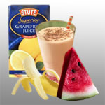 Jims food tip of the
day: The one and only Abraham Smoothie
Jims food tip of the
day: The one and only Abraham Smoothie
According to Jim he makes a wicked smoothie
It's dead simple just put low-fat yoghurt, diet grapefruit juice, watermelon, banana and a handful of almonds in the blender and whammo you got ya-self a really good smoothie!
Breaking the mould
The guidebook doesn't mention going on to Van Damme
State Park tomorrow. It has somewhere else in mind,
but Ali has planned a route that will get us to just
outside San Francisco in three days. The guidebooks
suggestion is four days. Since most of the gang wants
to get there as quickly as possible too, they are all
eager to know what his plan is. It will mean a day longer
in San Fran before journeying to the concert at Big
Sur on the last day of the month. It will also mean
a few burning muscles, with three days of 96km (60mi);
112km (70mi); 112km (70mi); along some pretty undulating
coastline, but as a group you generate support for one
and other. For some crazy reason, if you know that more
than one other person is suffering just as much as you,
then it's alright. With a couple, there's only ever
a simple two-way comparison. Digging even deeper now,
with a male and a female, it's more often than not a
forgone conclusion who is stronger. Unfortunate, but
that's just the way it is gals and sometimes it sucks.
It seems everyone, except Sue and Dave, is into ploughing full-speed ahead and ignoring "the guidebook standard". We are prepared for a couple of really full-on hills today. Again, I wish I hadn't even looked at that damned book, because it appears that the first pinnacle of the day will be energy draining. I find it a steady, but easy climb. Initially from the campsite there's a steep drop down to 213m (700ft), and from here we need to climb up through the 396m (1300ft) altimetres of forested overgrowth. This is this highest point on the Pacific coastal route, and from here you spiral and curve down for a never ending eight miles.To be honest, I almost feel seasick. Jim eagerly admits that he never thought he would get bored with going down hill, but today it happened.
The second hill of 700 altimetres was steeper and more thigh crunching for all concerned today. Jim gets to the top and tells us he nearly died. And there is another drop before spitting us out onto the seaside cliff edge. It is fairly obvious that the road doesn't exist for long in these parts and it must cost the road department a fortune in keeping it repaired. It still never ceases to amaze me that they call this a bike route. It is so not, as far as the road conditions are concerned. Landscape-wise it is stunning, but I seem to spend more effort riding than looking around me. We accomplish 40 kilometres, before stopping in Westport at the local deli for lunch. Hamish and Ida roll in as we are trying to finish up, but Jim seems to have got some guy on a roll and between the two of them they talk solidly for 45 minutes.
Gift of the gab
Jim just loves to talk, with anyone really, doesn't
matter. How he ropes them in, is such a fine tuned art
that he has obviously been perfecting throughout his
whole life. Probably unwittingly too. I've been watching
him over the last week and honestly, so many of his
conversations start at random that I can only boil it
down to intuition. Let's take today's situation as an
example: a V-8 whatever draws up, the guy's obviously
a local by the way he waves at everyone wandering around,
and they wave back. In perspective, that's not hard
in Westport, because it has a population of 58 people.
There is a fire fighters emblem on his car and then
Jim just comes out with: "Hey you weren't stationed
at Pendelton, were you?" Pendelton is an army base
south of Laguna Beach, where Jim comes from. His Grandma
built a tent house there back in 1915 and although they
now have a house on the plot of land, it's been in the
family ever since.
This guys goes like "No shit. Yeah I was stationed in Pendelton". Jim goes like "No, shit!" and so the story unfolds. We find out again about a whole bunch of stuff that we already know about Jim, but it is always a pleasure. And we practically get to hear the whole "This is your life" story of this guy, who was in the Marine Corp based at Pendelton, who took off up the coast after being laid off from some company that Jim's Uncle also worked at and he ended up dropping his transmission in this very town. He got some temporary work to pay for the work needed to repair his car, but in the meantime he met a girl and he's been married to her for 20 years now. He has two teenage girls of whom the oldest can shoot and fight and probably spit too, although he didn't mention the last quality. A whole pile of other stuff about this coastline, abalone, grass, his trip to Australia, bush fires, helicopters, poaching deer and man I could go on forever. But, for the life of me, I can't remember his name. You know, I think we found that out in one of the last few sentences of their conversation, and to be honest by that stage I wasn't really listening anymore. We needed to be hitting the road. We still had a bucket load of kilometres to pedal.
Come on girl, you can do
it!
It is a really tough leg of the journey that follows.
The road is persistent in going up and down at lengths
and gradients that not only annoy you, but zap the energy
out of you too. Adding to the displeasure, my bottom
bracket is so dangerously loose that I actually take
to talking to my bike: telling her to "Hang
on in there. Only a few more days, girl. You can do
it!". Trouble is, due to the sloppy bracket,
my crank wobbles so much that it puts incredible strain
on my chain when climbing and even more frustrating,
my chain keeps slipping and prevents me from finding
quite a number of my gears. If it were on the flat,
there wouldn't be so much of a problem, but it's far
from flat here. It's of Belgian Ardennes resonance and
I need every one of my cogs. If you don't have a clue
what I'm talking about then watch this video .
Why then have I left it so long to repair, you might ask? Well, I noticed a slight slackness close to the Canadian border, but I figured it would be cheaper in the US (which it is), but what I hadn't counted on, is the difficulty of the terrain (which it is). Basically, that's it. It's a bit slack I know and I've learnt my lesson the hard way because not only do I have to push harder than normal uphill, but I've totally worn out my cassette and cranks, and the chain is completely stretched that the whole lot needs replacing. But, in San Francisco then. If she hold's out. "Come on girl. You can do it!"
I know what you did last
summer in Fort Bragg
Not sure what time it is when we hit the outskirts of
Fort Bragg, but it's late afternoon. Jim needs a toilet
break and so do I. Ever so conveniently erected in a
parking bay near the seaside, is a moulded plastic porta-loo
the size of a city apartment's bathroom. It stinks none
the less, for it's size and the "I did Leonie in
here and she was good" graffiti sort of explains
the sinister vibe we all feel in Fort Bragg.
Clearly, our objective is to get to the nearest supermarket for supplies and then out again. We are intent on travelling along the No 1, but a woman quite concernedly asks if we are from round here or not. Next thing I know, she is insisting that we use the old logging trail running along the beach instead of the highway. According to her, this is the worst stretch of road along the coast for accidents. I always find this sort of in-your-face do-gooder-help a bit annoying, but this girl doesn't let up. She pulls me aside and says: "Huuney, I yewsed ta ride my bike aah lot and yah know what em fellaas yewsed ta say ta me? Dey yewsed ta say: Whaaad goods that helmet gonna do ya, when I hit ya wiv my truck? Aaand I'm a local!" A guy in his mid twenties with about as many teeth as someone in their mid eighties confirms her story and adds: "Yeah, yah auwl gottaz much right ta da road as dey. I'd say evin more, but dey don't care yewz see." I immediately go and check out the lane they have in mind.
Turns out the logging trail ends only half a kilometre down the road, and considering the life threatening road conditions we have had to date along this bike route, I can hardly believe that such a short distance is any worse. Before we descend on the Safeway like a pack of crazy barbarians, Jim spies an outdoor store, which will sell him enough white gas to fill up his fuel bottle. Like so many things in America, it only comes in the big size. Carting 3.8 litres (1 gallon) of flammable liquid around with you on a bike is neither wise nor good for keeping the pack-weight down.
Safeway is a short ride up the road. While the rest of us wander the aisles in search of food, beer, wine, snacks and even more food, Ali stays outside to keep an eye on all the bikes. It definitely seems necessary in Fort Bragg. After spending your whole day pedalling the coastline, vulnerable as you are outside, with nothing between you and the elements, it's a really weird feeling being confined to a supermarket. All those pathways with limited vision, just produce and advertising, the choice, the convenience of it all. We are so removed from the average big chain supermarket populace in nearly every way you can think of.
I pull up to cash register No 2, with a utterly laden basket. I'm cooking for the team tonight. I've barely got the asparagus out and a man joins the queue behind me with only two items clasped in his hands. I tell him he can go before me. He is so stunned, that I thought he didn't understand me, so I repeat myself. He slides tentatively passed, thanking me but looking at me as if I am totally mad. As he puts the beer and bread on the conveyor he says: "People from here don't do that" I reply, "I'm not from here."
Now, I've only been in town for less than an hour, but the two conversations I've had so far are enough to make you think this town is ripe for the next slasher movie. I mean, my last tête-à-tête could easily be the opening scene of a Friday the 13th type sequel, where a logging truck driver, takes his revenge out on a group of cyclists at a hiker biker site. Even the name Fort Bragg lends itself to macabre and gruesome thoughts. No. I know. Instead, we could turn the whole thing around and make it cyclists in search of the guy who took his revenge just one year prior out on their mates. Before they find him they could torture a series of logging truck drivers to death. You know, we could call it "I know what you did last summer in Fort Bragg"
Burn that witch
Van Damme State Park - near Mendocino (94km; 1207m) is easy enough to reach, but it is the end of a tiring
day. The woman at the kiosk obviously feels exactly
the same way. The hiker biker area is apparently really
crowded and she tries to get us to pay for a normal
campsite: $20 for the four of us, which would mean more
per head than the usual $3 fee. Jim gets a bit smart
with her and I also see no reason why we should pay
extra, just because they haven't got enough space for
all the cyclists. Besides, there is plenty of room in
the campground. She does that smile through gritted
teeth thing while telling me it isn't her fault that
all the hiker bikers have turned up on the same day.
Well, I got new's for her too:, it aint my fault either.
During the somewhat tense discussion, she asks if Jim is over 62, because then he could get a discount. This doesn't go down at all well with him and so he continues to niggle her. And I have to admit, she deserves it. She gets all official like at one point and comes out of her office to disclose her rank and order or something like that. That only gives Jim cause to get into one of his spiels about about how he is Californian born and raised and since has paid his dues in this state, he has earned the right to stay in a State Park for the hiker biker price.
Ali is the mediator and does a good job of it, but I have to point out here, he's actually the reason so many cyclists are here tonight. If he hadn't suggested the three day to San Francisco route, then they'd all be elsewhere. The elsewhere that the guidebook had in mind. Anyway, I've digressed, because Lisa at the kiosk has finally come to her senses and called the ranger, who gives us the okay with no further fuss to pitch on a normal site. It was that simple. Jim cycles off and as soon as he is out of hearing range announces: "They should burn that witch at the stake".
I just wish those hills
would stop
It starts immediately today and just does not let up.
We go up and down so many times, I'm completely shaken
up. Scenery is pretty spectacular, but it only captures
my attention until the burning thigh feeling takes precedence.
Just out of Elk, where pause to refuel and pump some
caffeine into us, there is a set of double switchbacks
that according to Jim are "brutal". A truck
came passed as I hit the second one and forcing me to
stick to the inside curve. This registered a gradient
of 20%, so there was no way, even if my bike was slickly
performing, I could ride up that, so I got off and pushed.
It amazed Jim that I was pushing almost as fast as he
could pedal.
There's hardly any shoulder along most of the road today, so it's pretty hairy at times with traffic. In parts it is also frustratingly busy. The sticky sweet scent of either eucalypt or pine follows us much of the way to Gualala, where we stop and take advantage of the numerous opportunities for stocking the supply bags up. And then it's back in the toe grips for some more hilly terrain, before finally arriving at Stillwater Cove State Park- near Fort Ross (112km; 1380m). Jim's comment as we stagger around trying to find a flat bit for our tents pretty well sums up everyone's feelings: "Used to be fifty-six and kicking arse, but now I'm fifty-six and getting my arse kicked".
Discovering yourself and
the third gear
The raccoons stole Jim's bagels last night, so I share
our packet with him and Brian. We leave early enough
all with our jackets on, but within 10 minutes of riding,
they have been shredded. It's warm in the sun. Beautiful
weather in fact. I wish the ride was the same. I've
kind of had enough of all this undulation. The hill
just outside Jenner is a killer. I'm hungry and have
to stop to eat. Ali has other ideas, like cycling another
10 miles, which in this terrain could mean an hour.
I know it's 11.15am and I know we have only done 11
km (17 mi), but here's no way I'll last that distance
without a stock up of energy. First available turnoff
I pull over. Ali is not happy. Jim comes on up behind
and just drops the bike and lies down on the bitumen.
He is happy.
Back on the bikes we pedal up and down the whole way into Bodega Bay, where the boys need to buy some supplies and I really want a coffee too. Ali is pissed off that we are not making good headway, but I try to explain to him that everyone needs to refuel and everyone feels that at different times. Besides, how were we to know that the territory was going to be so hilly. Ali sulks, the whole time sitting on his bike and arms crossed, while the three of us quickly snack and drink coffee. It is decided that we will stop for a decent time in Tomales, but there are a couple of killer hills in between then.
By the time we reach the quaint little village, it's definitely time for a long cold energy drink and some stodgy food. Apart from a 3 kilometre stretch along a string of oyster restaurants, the road just continues to go up and down ad infinitum until Port Rays where we stop for supplies. Can't say I noticed much about anything really: too busy trying to keep the rhythm going. I could remark that it was brown and dry in parts, that we saw quite a number of cows this morning and seals as well and I couldn't help smelling the big eucalypts along the way. Oh and I almost forgot to mention it, but Jim discovered his third crank today. He was really pumping up and down those hills!
From Port Rays it's a left turn up a major incline. I hear someone behind me, who I think is Jim, going smoothly through the gears and I think, wow you've finally mastered it. When I stop at the top, its actually Casey. He camped with us last night, but we hadn't seen him all day until the supermarket stop. The road plummets down and then levels off for seven kilometres or so. We are all elated about arriving at Samuel P Taylor State Park - near Olema (108km; 1408m), and as we pull into the hiker-biker area, more elation is to be had as Dani comes flying down from above to give Jim and us a big hug. And we thought we'd never see him again.
We also thought we'd not hear about Jim's famous shrimp taco's but there you go, we were wrong. They came up at random, somewhere in the conversation again tonight. So, here ya all go:
 Jim's food tip of the
day: shrimp and cabbage tacos
Jim's food tip of the
day: shrimp and cabbage tacos
Fill a couple of taco's with fresh shrimp, top with sliced cabbage and warm on the BBQ. When ready top with creamy ranch dressing.
Jim always buys cooked shrimp, none of that raw
stuff for him.
He just doesn't trust it: and besides it is conveniently
available at Costcos for a pretty good price.
As an alternative, Jim also recommends using tuna fish.
The trip into San Francisco tomorrow is one extreme to the other. We follow a bike route all the way to the Golden Gate Bridge. There are few tough hills, especially the one leading up to the bridge. A mist bank has covered most of the area, the skies above the fog are blue. Crossing the bridge is hard work, the wind is strong, but the worst part is all the foot traffic and other cyclists. Way busier than I had imagined. After that we say goodbye to Dani for the second time and then to Jim.
We have cycled two weeks with Jim and all throughout his spirit was amazing. We both marvel that someone at his age, would make the decision to cycle the Oregon and Californian Coast, when they had never done anything like that before. We never stopped laughing the whole time with Jim and we learned a lot about his life. His repetitiveness made sure of that. I'm sure this trip has taught him a thing or two about himself that he didn't know before. One thing is for sure, it's a wonderful achievement and setting out on such an adventure takes courage and spontaneity, but above all it shows strength of mind and character. We'll miss you Jim.
Lead you through the streets
of San Fran
Brian obviously knows this city pretty well, as he deftly
weaves us through the streets of San Fran and drops
us off at the BART station at Mission. We have arranged
to meet tomorrow evening for dinner, so there's no need
for goodbyes with him quite so soon, though I will take
this opportunity to say what a really cool person Brian
is. Cool as in on the ball. Cool as in collected and
observant. Cool as in enjoying a laugh as much as anyone.
We feel privileged to have met his acquaintance. In
fact, nearly everyone we met cycling down the coast
was bizarrely unique in their own way. I suppose it
takes that sort of character to do embark on such a
trip in the first place.
Returning to the Boomerang Bar
to be continued...
We catch the train to Oakland (68km; 544m),
where we will be staying with Molly, a woman who cycled
with us for a couple of weeks in Pakistan. It'll be
fun catching up and we need some R+R badly, the website
needs urgent attention, as do our bikes. And while we
are in a big city, it is also time to stock up on some
new clothes too. The other highlight is going to be
the return to Haight and Ashbury. Ali and I first met
there back in 1994, but that's a story in itself which
I'll leave until next time.