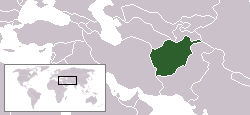
Islamic Republic of Afghanistan
Area: 647,500 sq km
Population: 32,738,376
Population density: 46 per sq km
Capital: Kabul

Islamic Republic of Afghanistan
Area: 647,500 sq km
Population: 32,738,376
Population density: 46 per sq km
Capital: Kabul
| Visa required ? | |
| British | Yes |
| Australian | Yes |
| Canadian | Yes |
| USA | Yes |
| Other EU | Yes |
Passports
Passport valid for at least
six months required by all nationals referred
to in chart above.
Visas
Required by all except the
following:
(a) travellers holding a re-entry permit issued
by Afghanistan;
(b) transit passengers not leaving the airport
and continuing their journey within two hours.
Nationals not referred to in the
chart above are advised to contact the embassy
to check visa requirements.
Types of Visa and Cost
Single-entry: £30. Double-entry: £40. Multiple-entry: £55 (up to three months); £115 (up to six months); £145 (up to one year).
Enquiries
should be made at the embassy for details about visiting Afghanistan.
Validity:
Tourist: one month from date of issue. Duration of stay depends on purpose
of visit.
Visa Restrictions:
The government of Afghanistan refuses admission and transit to nationals of Israel; but they will accept other passports containing Israeli stamps or visas.
For more info, check http://www.mfa.gov.af/Visa.as
By Air
The national airline is Ariana Afghan Airlines (FG)
Approximate flight times to Kabul:
Istanbul: 4 hour and 30 minutes
London: 7 hours
New York: 13 hours and 30 minutes
Dubai: 2 hours
Singapore: 6 hours and 20 minutes
Sydney: 14 hours and 10 minutes
Buenos Aires: 19 hours
Main (international) airports
By Road
Afghanistan has borders with all its neighbours, except China.
Border crossings with Iran are between Islam Qala and Taybad on the Herat - Mashhad road in the north-west and between Zaranj in Nimruz province and Milak in Iran in the south-west.
The WeeshChaman border crossing at Spin Boldak, Kandahar province is one of the main border crossings with southern Pakistan. The road connects Kandahar and Quetta. The other border that is open to foreigners is the famous Khyber Pass at Torkham, which connects Jalalabad and Peshawar.
There are four crossing points between Afghanistan and Tajikistan:
A first bridge connecting the two countries opened in 2002 and crosses the Panj River at Tem-Demogan, just north of Khorug. (location on GoogleMaps)
The Tajik–Afghan Friendship Bridge (opened in 2004) connects the two banks of the Amu Darya river at Khorug.
A third bridge opened in 2006, connecting Ishkashim with Ishkashim (location on GoogleMaps).
From Shir Khan Bandar a ferry will take you across the Panj river, a tributary of the Amu Darya river, to the Tajik town of Panj-e Payon. You can also cross via the Nizhniy Pyandzh (or Dusti) bridge, which opened in 2007 (approx. location on GoogleMaps).
The Afghanistan–Uzbekistan Friendship Bridge is the sole connection between Uzbekistan and Afghanistan, connecting the towns of Heyratan with Termez in Uzbekistan (location on GoogleMaps).
Towraghondi in Herat Province is the Afghan border town connecting to Serhetabat in Turkmenistan (location on GoogleMaps). The road connects the cities of Herat and Mary (Turkmenistan).
By Rail
There are no passenger services available to other countries.
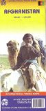
Afghanistan Map
International Travel Maps
scale 1: 1 000 000
Waterproof
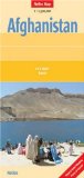
Afghanistan Map
by Nelles Verlag
scale 1:1 500 000
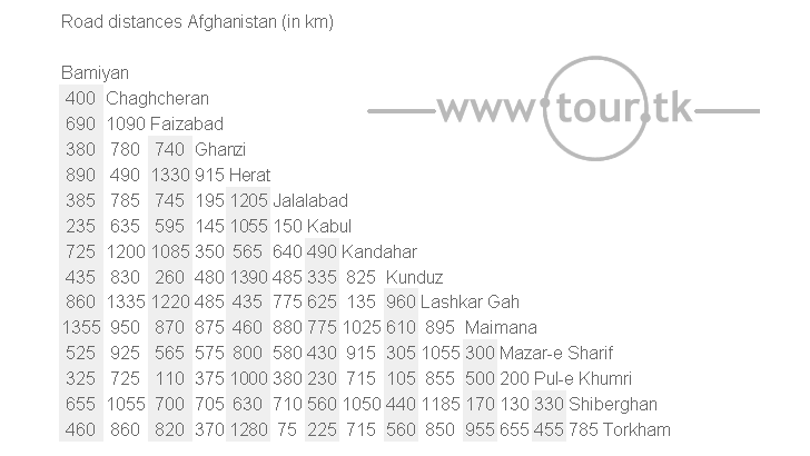
Road distances map of Afghanistan from 2000 (pdf). Shows districts, borders, roads & distances.